


Simrad: Companion for Boaters
4.3201.00 Reviews
App Specs
- Version
- 4.6.0
- Updated On
- License
- Free
- Downloads
- 100,000+
- Developer
- Navico Norway AS
- Categories
- Maps & Navigation
- Platform
- Android
Screenshots
 Analysis by AppCompare
Before leaving the dock, I like to make one simple check: is the phone ready to be useful on the water, rather than just charged? A boating app is only as helpful as the chart information and habits built around it, so I would treat Simrad: Companion for Boaters as one part of a navigation routine, not as a replacement for paying attention to the water. That distinction matters most when conditions change or the route passes somewhere unfamiliar.
Start with a repeatable pre-departure routine
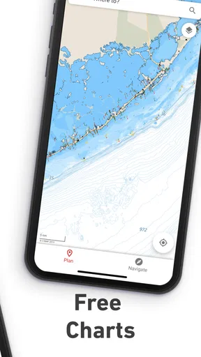
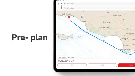
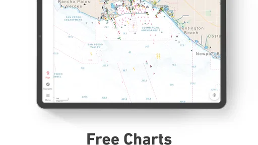
My practical approach is to open the app while still ashore, look over the intended route, and make sure the chart view is showing the area I expect to travel through. If I have a destination in mind, I would plan the broad route before casting off, then use the phone’s position as a reference during the trip rather than trying to make every decision while underway. A few calm minutes at the dock are worth more than hurried screen work in a busy channel.
I would also keep a second source of orientation in mind: visible landmarks, local knowledge, and the boat’s other navigation equipment where available. GPS can make it easy to follow a moving marker without thinking about what lies around it. Looking up from the screen is not an optional extra; it is part of using any chart app sensibly. For a new anchorage or an unfamiliar stretch of coast, I would review the route before departure and leave room to change plans if the actual conditions call for it.
Choose the right role for the phone
The app is most appealing to people who already enjoy planning trips and want nautical charting close at hand. It can also be useful for a regular crew member who wants to follow the route and understand where the boat is headed, even if that person is not at the helm. I would be more cautious about recommending it as the sole navigation tool to someone who expects a phone to solve every on-water problem. A chart display cannot make a poor route safe, and a phone should not distract the person responsible for steering.
Compared with a general-purpose map app, a boating-focused companion is the more natural place to think about nautical charts and cruising. A standard road map is designed around streets and driving, not a boat’s relationship to water and shore. On the other hand, someone who only needs a simple overview for a familiar, short outing may find a dedicated chart plotter or an established paper-chart routine more comfortable, especially if that is already how the boat is set up. The best choice depends less on having the most screens and more on which source you can read reliably while keeping watch.
Settings and costs are part of the decision
Before relying on any charting app, I would check that the phone’s location service is available and that the app is set up for the area and kind of trip I plan to make. I would also check the screen brightness and power situation before leaving shore: a display that is hard to see or a phone running low at the wrong moment quickly becomes a nuisance. These are plain preparations, but they prevent a lot of avoidable fiddling once the boat is moving.
Simrad is free to install, with in-app purchases ranging from $14.99 to $89.99 per item. I would look closely at what a purchase covers before paying, then decide whether it matches the waters I actually visit and the way I use the app. Free access is a low-friction way to explore the interface, but it is sensible to settle the chart coverage question before building a trip plan around a paid option. The app is rated for Everyone, and its current version is 4.6.0; it requires Android 10 or later.
Worth Reading Before You Choose

EA SPORTS FC Mobile 26 Is a Bigger Football Game, but It Takes Time

Flipboard Shows What News Apps Must Do Beyond the Feed

Switching to Android Auto Means Rethinking Your Driving Routine

Google Calendar Makes a Crowded Week Easier to Manage

Ludo King Makes the Most of the Minutes Between Plans

Baby Panda World Brings Quick Play to Modern Phones, but Its Game Library Feels Busy
There is a useful distinction between experimenting with an app at home and depending on it afloat. At home, I can take time to learn where the main chart controls are and how I prefer to view a route. On the water, I want fewer touches and less uncertainty. A repeatable setup—checking the destination, opening the relevant view, and keeping the phone where it can be seen without obstructing the helm—helps make the app feel like support rather than another task competing for attention.
Your Digital First Mate
The first thing that caught my eye about the Simrad: Companion for Boaters is how user-friendly it is. As soon as you launch the app, you're greeted with a sleek interface that just screams, "Let's set sail!" You don’t need to be a tech wizard to navigate through its features, which is a huge plus when you’re trying to focus on steering your vessel.
Nautical Navigation Made Easy
One of the standout features is the real-time GPS navigation. Let’s be honest, having accurate charts is a game-changer. The app updates your location as you cruise along, ensuring you’re always on the right track. It's like the app is whispering in your ear, "No, no, a bit more to the starboard side!"
And for those moments when you’re just not sure if the weather will play nice, Simrad’s got you covered with its weather overlays. It’s like having a personal meteorologist aboard. With tide data and detailed forecasts, you can plan your trips with confidence, keeping those stormy surprises at bay.
All Hands on Deck: Features Galore
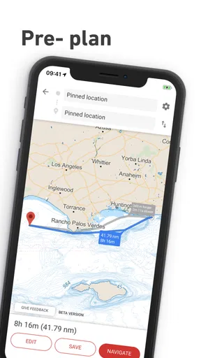
Now, let's talk about some of the other handy features packed into this app. The route planning tool is a lifesaver. It’s super intuitive, allowing you to plot out your journey with ease. Not to mention the ability to save your favorite spots; think of it as dropping virtual pins for future adventures.
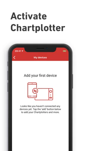
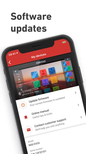
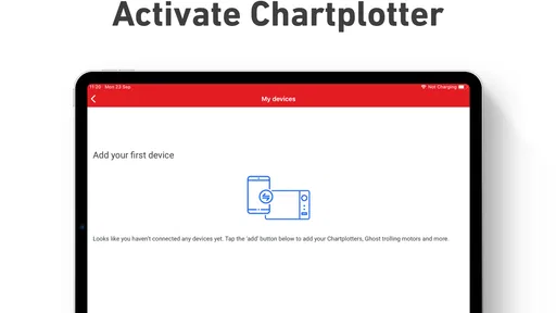
Another cool feature is the integration with your Simrad chart plotter. If you’ve got the hardware on board, the app syncs up effortlessly, giving you a seamless experience. Imagine pulling up to your destination and having all your tech work in harmony—pure sailor bliss!
Anchors Aweigh: The Social Side of Sailing
One of the unexpected delights of the app is its community aspect. Connect with other boaters, share your routes, and swap stories of the sea. It’s like a digital marina where you can drop anchor and chat about the day’s catch or the best hidden coves.
Plus, the app includes a nifty feature that lets you log your trips and share them with friends. So next time you’re boasting about that epic sail around the bay, you’ve got the receipts to back it up!
Turn a familiar trip into a useful routine
A repeat visitor to the same harbor can get more value from saved places than from constantly rebuilding a route. I would use a saved spot as a planning reference, then check the approach anew each time rather than assuming yesterday’s conditions still apply. A familiar destination can still have a different safe approach depending on weather, traffic, water level, or the boat’s needs. The benefit is less time searching for the place in the app, not permission to stop assessing the surroundings.
For a day trip, I would think in stages: the departure point, a possible stop, and the return. That gives the crew a shared sense of the plan without turning the phone into a running checklist at the helm. If the outing changes, the route-planning tool and saved locations can help make a revised plan easier to communicate. I would still keep the decision-making simple: one person navigates, and the person steering stays focused on the boat and nearby traffic.
Where the companion approach has limits
The strongest case for this app is a boater already using Simrad equipment or someone who wants chart-oriented trip planning on a phone. Its relationship with a Simrad chart plotter may make it a more coherent companion than a standalone general map for that setup. If your boat uses another electronics ecosystem, or you are happy with a different charting workflow, switching just to add another app may create more duplication than value.
I would not treat a phone app as a substitute for a dedicated chart plotter in every situation. A fixed display can be easier to consult at the helm, while a phone is portable and familiar but brings the usual practical concerns of visibility, battery, and handling. Nor would I assume that an app’s route line accounts for every local hazard or changing condition. It is a planning and awareness aid; the skipper remains responsible for checking charts, observing the water, and using suitable backup practices.
For someone deciding whether to try it, the key questions are straightforward: do you boat often enough to benefit from planning and saved places, do you want a nautical charting companion on your phone, and does the Simrad connection fit your onboard equipment? The app has a 3.7 average from around 1,500 ratings, with over 100,000 installs, so it has found an audience, though those figures do not tell me whether it suits a particular boat or cruising area. Navico Norway AS develops it, and it was released on May 20, 2020.
Setting Sail with Confidence
In a nutshell, the Simrad: Companion for Boaters is a fantastic tool for anyone who loves the water. Whether you’re a seasoned sailor or a weekend warrior, this app has something for everyone. It’s packed with features that not only make boating safer but also more enjoyable.
So, if you’re looking to enhance your maritime adventures, give Simrad a try. You’ll wonder how you ever set sail without it. Now, time to hoist the sails and let the sea breeze take you to your next adventure!
My recommendation is to approach it as a companion that earns its place through preparation: learn the chart view before departure, plan routes when you are not rushed, and use saved places to make repeat outings smoother. I would choose another option if I needed a different hardware ecosystem, preferred a fixed chart display, or wanted only the simplest possible aid for occasional familiar trips. For boaters whose habits already include checking a route and staying aware beyond the screen, it offers a practical phone-based addition to the routine.
Pros
- User-friendly interface for easy navigation.
- Real-time weather updates enhance safety.
- Advanced route planning features.
- Seamless integration with Simrad devices.
- Comprehensive vessel monitoring tools.
Cons
- Limited offline functionality.
- Subscription required for premium features.
- Occasional connectivity issues.
- High battery consumption.
- Complex setup for first-time users.
FAQs for Simrad: Companion for Boaters
What features does the Simrad: Companion for Boaters app offer?
The Simrad: Companion for Boaters app provides an array of features including real-time GPS navigation, route planning, weather updates, and sonar data integration. Users can customize charts, access detailed marine maps, and benefit from AIS (Automatic Identification System) for safer navigation. The app aims to enhance the boating experience with its comprehensive tools.
Is the Simrad app compatible with all types of marine equipment?
The Simrad app is primarily designed to integrate smoothly with Simrad marine electronics. However, it also offers compatibility with a range of other systems through NMEA 2000 and Wi-Fi connections. For the best experience, verify that your equipment supports these connectivity options before downloading.
How user-friendly is the Simrad app for beginners?
The Simrad app is designed with user-friendliness in mind. It features an intuitive interface, easy-to-navigate menus, and provides helpful tutorials for new users. Beginners can quickly get accustomed to its functionalities, making it an excellent choice for both novice and experienced boaters.
Does the Simrad app require a subscription for full access?
While the Simrad app offers a free version with basic features, accessing the full range of functionalities requires a subscription. The premium version includes advanced features such as detailed chart overlays, enhanced sonar data, and weather forecasting. Prices and subscription plans can vary, so it's advisable to check the latest details on their website.
Can the Simrad app work offline?
Yes, the Simrad app allows users to download charts and maps for offline use. This feature is particularly useful for boaters who travel to areas with limited or no internet connectivity. By downloading necessary data in advance, users can ensure continuous navigation support even when offline.


